When Villages Draw the Map: How Participatory Planning Is Protecting Forests in Aceh and Riau
7 minutes read
In 91 villages across Aceh and Riau, communities have mapped their own land, agreed what to protect, and written those decisions into village law. Now one district in Aceh wants every village to do the same, and 25 villages are paying for it from their own funds
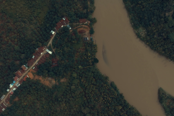
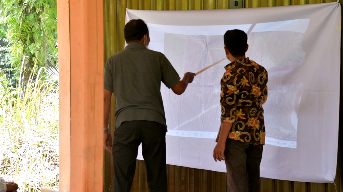
In Kerumutan Village, Pelalawan District, unclear boundaries between the village, neighbouring villages and nearby companies had led to overlapping claims over land. Through PLUP, the community sat down with different stakeholders to discuss these boundaries and map the area together, creating a clearer picture of land use and providing recommendations that could inform local spatial planning, said Khotim, Grievance Specialist at Earthworm Foundation Indonesia.
Stories like this are common. In many Indonesian villages, no one can say for certain where the village ends, who holds which land, or which forest is meant to be protected. Detailed maps often don’t exist. District and national spatial plans frequently don’t match what villages have planned for themselves.
The result is uncertainty over land use, a higher risk of conflict, and villages that struggle to make the most of their land, whether for farming, income or conservation.
Putting Communities at The Centre Of Planning
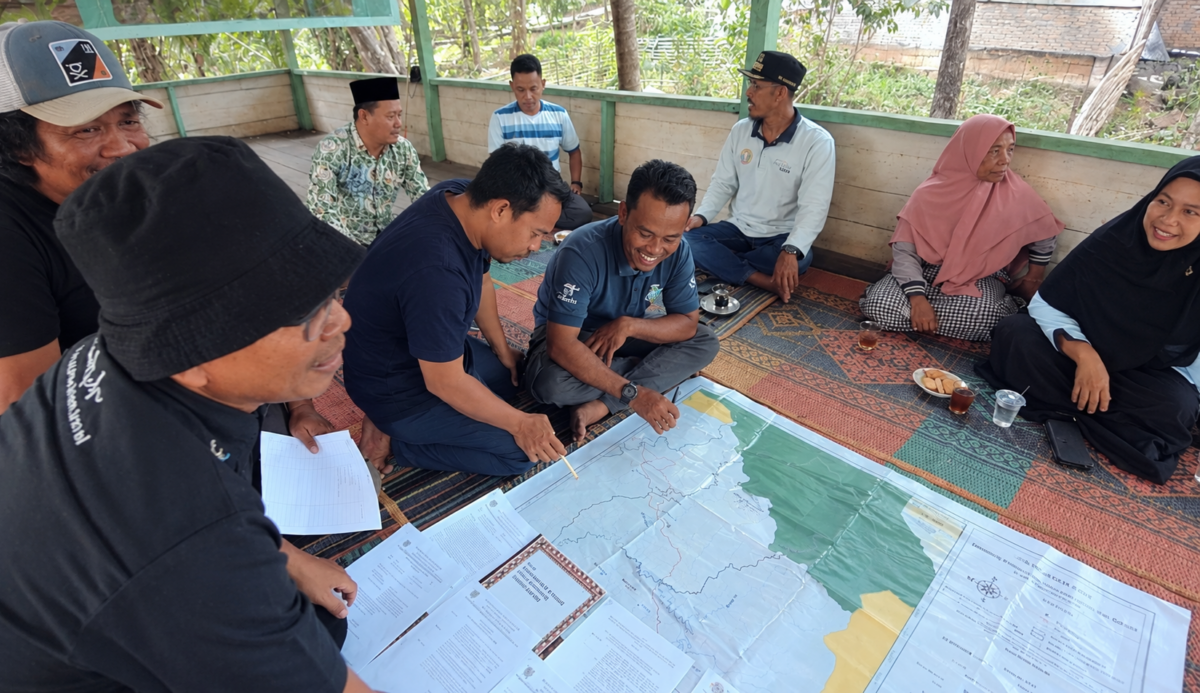
Participatory Land Use Planning (PLUP) brings villagers, village government and other local stakeholders together to map their land, talk through the problems, and agree on how each area should be used: farmed, protected or developed.
Because villagers draw the plan themselves, they are more likely to own it and to keep following it after the facilitators have gone. That sense of ownership is what separates a living plan from a document on a shelf.
For Earthworm Foundation (EF), PLUP is usually the first step of its work in a village. It links what communities need on the ground with district and national planning. The process follows the principle of Free, Prior and Informed Consent (FPIC),with all stakeholders involved in an open and transparent planning process. In practice, key decisions are discussed and agreed through open village meetings, where communities can participate and give their consent.
How It Works
PLUP generally runs in six stages:
- Getting to know the village: building relationships and understanding local context and stakeholders.
- Collecting data and mapping: resources, land use and boundaries.
- Analysing key issues: the challenges and opportunities that shape how land is managed.
- Planning workshops: agreeing on management priorities and programmes.
- Drafting the PLUP report: bringing together the maps, analysis and agreements.
- Public consultation: everyone involved reviews the plan and gives feedback.
What a Village Has at the End
- A map with agreed village boundaries and current land cover and land use
- A picture of who holds and uses which land
- Management zones: what is to be protected, farmed or developed
- Key issues and a strategy for managing them
- Recommendations that can feed into district development plans
What Villages Have Achieved
EF’s work in Aceh and Riau shows how village-level plans can add up to change across a whole landscape.
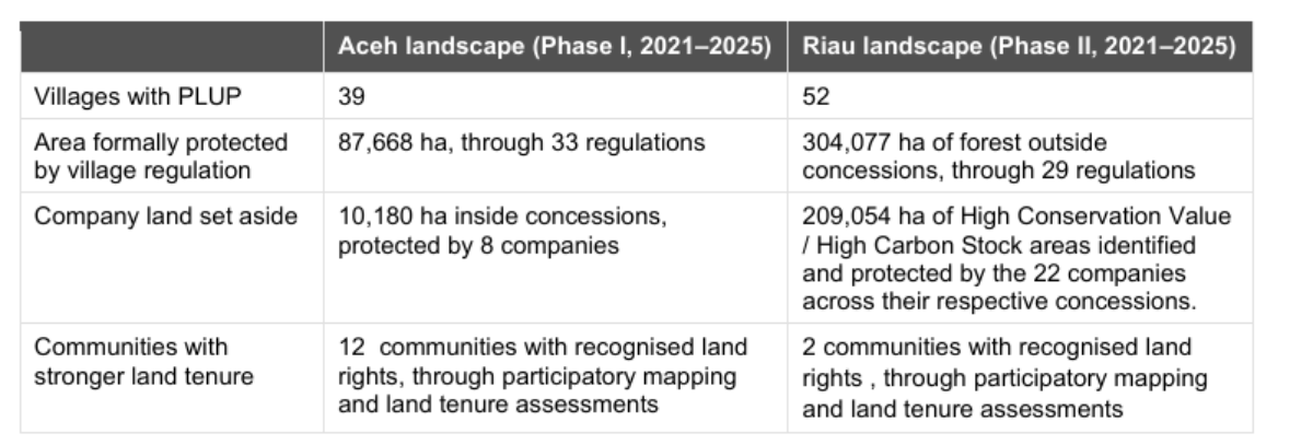
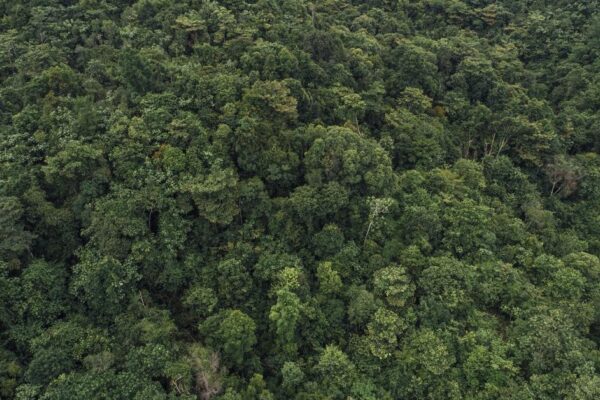
To give a sense of scale: the area protected by villages though their own regulations cover around 876 km² in Aceh and 3,041 km² in Riau, both are larger than Singapore.
A Map Is Not Enough
Maps and plans alone don’t guarantee that anything changes on the ground. Two things help the agreements last.
The first is village law. Agreements reached through PLUP can be written into a Village Regulation (Perdes), which gives them legal weight at village level.
The second is people to see them through. Setting up or strengthening community-based organisations and village conservation groups gives the plan local guardians, who protect agreed conservation zones, make sure land use and natural resources are managed sustainability.
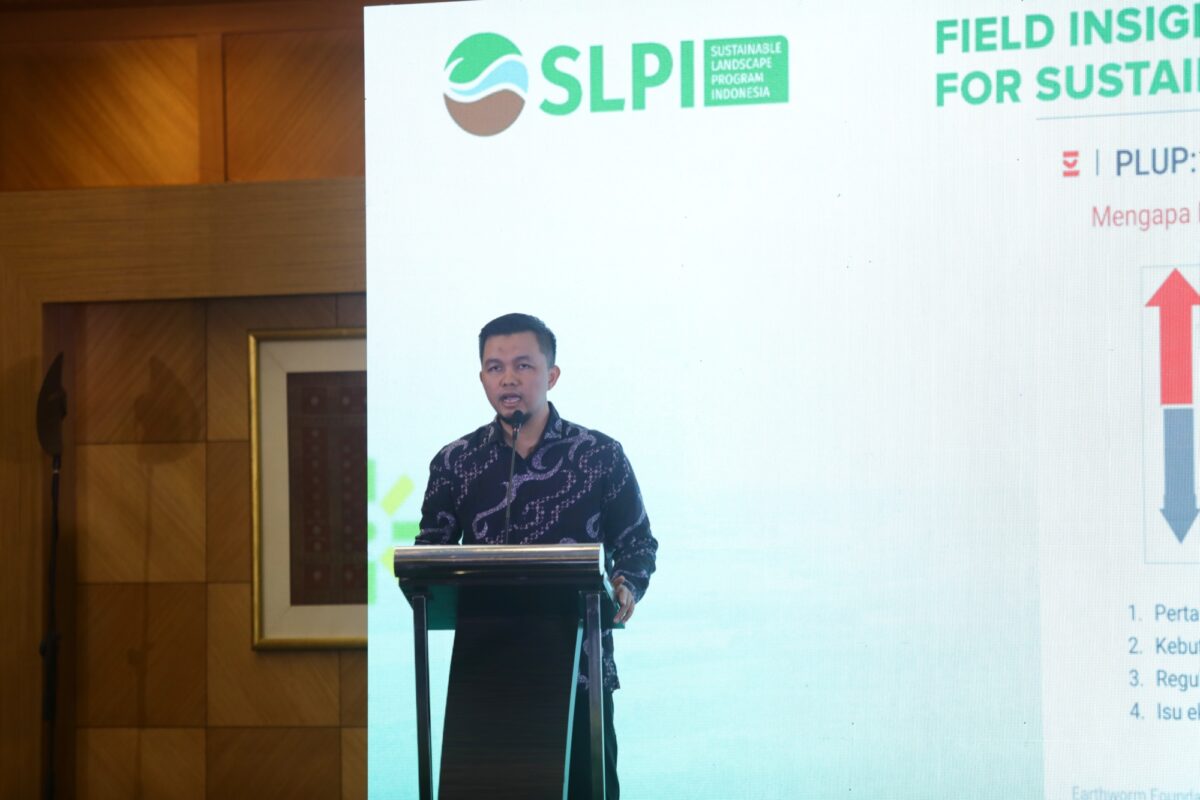
“Having a PLUP plan and the data behind it is only the first step. At village level, we need local institutions to help put the plan into practice and make sure the agreed land management continues,” said Rikto, Supply Chain & Engagement Manager at Earthworm Foundation Indonesia, speaking at Field Insight on Participatory Land Use Planning (PLUP) for Sustainable Landscape in Indonesia, organised by UNDP through Sustainable Landscape Programme Indonesis (SLPI), Jakarta, 1 April, 2026.
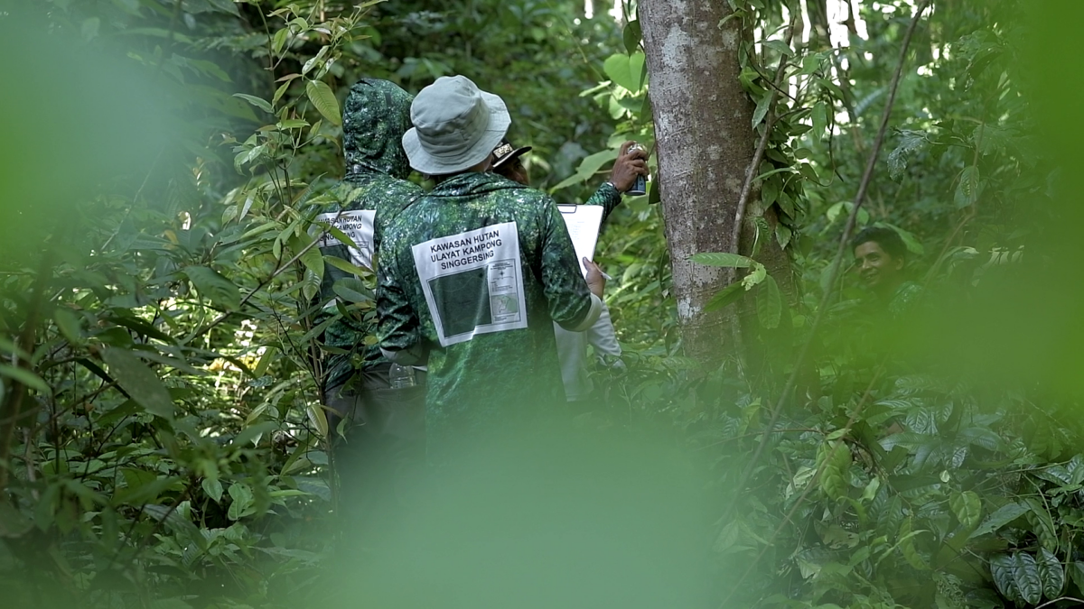
One example is the Village Customary Forest and Conservation group in Singgersing Village. “Since our group was established in 2022, we have been working as local guardians of the forest. We map the area, install boundary markers, carry out monitoring patrols at least twice a month, and help safeguard the protected zone of Singgersing Customary Forest,” said Anhar, leader of the Village Customary Forest and Environmental Conservation group.
From Village Maps to Policy
EF is working with the Center for Indonesian Policy Studies (CIPS) to bring these field lessons into policy discussions on land governance in Indonesia.
A CIPS field study in Aceh and Riau compared villages that had gone through PLUP with villages that hadn’t. Villages with PLUP had more detailed maps, clearer boundaries, a better picture of their social, economic and environmental resources, and planning that involved a wider range of stakeholders involvelment in planning. The study also found that PLUP helped communities clarify land tenure and address land use disputes. In Subulussalam, two PLUP villages, Singgersing and Namo Buaya went further agreeing to establish customary forest to protect their environment.
Local Governments are Taking It Up
The clearest sign that PLUP works is that local governments are now adopting it themselves.
In Aceh Singkil, the district government has committed to rolling out PLUP in all 118 of its villages, step by step. Twenty-five villages have already set aside part of their Village Funds to carry it out in 2026.
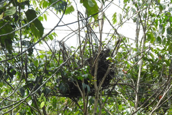
In Subulussalam, PLUP data is feeding into the city’s Detailed Spatial Plan and helping to resolve land conflicts. It has also led to new conservation work: protection zones mapped by Lae Ikan and Jontor villages lie largely inside Lae Kombih Forest Park, and prompted a biodiversity survey that found orangutans nesting there. Explore the Lae Kombih survey and findings.
Starting with The Basics
Better land governance can start simply: understanding the land, opening space for dialogue, and letting communities shape the future of their own land. Backed by solid data, shared agreements and local institutions, and kept up to date as conditions change, village plans can become part of how districts and provinces plan too.
****
The Aceh landscape programme is supported by ADM Cares, Avril Group, Colgate-Palmolive, Fuji Oil, General Mills, Givaudan, Hershey, Mars Inc., Nestlé, Reckitt, The Clorox Company and the Swiss State Secretariat for Economic Affairs (SECO), with active support from local communities, local governments and other stakeholders. For more information about the project, visit Aceh landscape page.
The Riau landscape programme is supported by Barry Callebaut, Clariant, Colgate-Palmolive, Givaudan, Kenvue, LVMH, Nestlé, PZ Cussons, Reckitt, Target and the Walmart Foundation, with the active participation of communities, government authorities and other stakeholders. For more details, visit Riau landscape page.